Range intensity registration |
|
Dana Cobzas,
Hong Zhang and
Martin Jagersand
|
ReferencesCobzas, D., Zhang, H. and Jagersand, M. A Comparative Analysis of Geometric and Image-Based 3D-2D Registration Algorithms, IEEE Conference on Robotics and Automation (ICRA) 2002, pp2506-2511 |
Demos | |
 |
An example of rendering using the second model (panorama registered with depth from laser rangefinder) |
Description
The registration of volumetric and intensity data acquired with different sensors is an important problem especially in the field of model building, realistic rendering, and has applications in engineering and medicine. The traditional geometric approach to the problem is to recover the rigid transformation between the sensors in order to register the two data sets. This is in general a nonlinear problem and it requires a good initial estimate in order to converge. In contrast, image-based techniques compute a direct mapping between the points in the data sets that recover the transformation under some constraints. We investigated the performance and applicability of geometric-based techniques and image-based techniques in the problem of registering intensity data provided by a CCD camera with depth data provided by a laser rangefinder placed near the camera. We derived and implemented two algorithms that use points and lines respectively to recover the 3D rigid transformation between the sensors. We contrast them with two newly developed image-based algorithms: an affine warp under ortographic camera assumption and a plane homography mapping based on laser scanlines. Experimental results shown that the nonlinear version of the geometry-based algorithms provide in general more accuracy but they are slow. The image-based algorithms are faster and better for particular cases (eg the affine warp performers very well when is little variation in 3D data) or when the camera has high distortion and it cannot be modeled as a perspective camera. We showed that they can be used in applications that require less precision but real-time performance like robotics applications. In a more recent work we compute a local image warp to align a panoramic image mosaic with a laser range scan to create an appearance map for robot navigation. Application to 3D model for oil sand
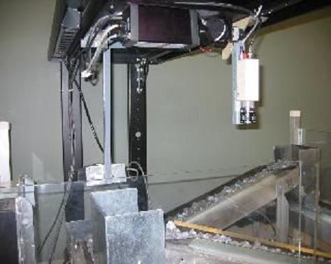
We applied the image-based registration algorithm to an industrial project that required getting a real-time 3D model of oil sand rocked moving on a conveyor belt. In this case the speed of the conveyor is calibrated before.
|
Back to Dana's research page

